

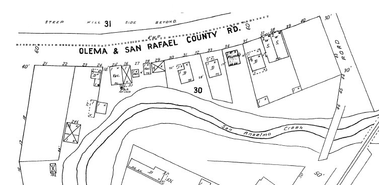
Partial 1909 Sanborn Map
Parcel maps for San Anselmo are available online from MarinMap. The Historical Museum has digitized copies of the Sanborn Maps for San Anselmo. Sanborn Fire Insurance Maps are highly detailed city plans providing researchers with a wealth of information about urban change in American cities during the first half of the 20th century. They were created to assist fire insurance companies as they assessed risk associated with insuring a particular property. They were drawn to a scale of 50 feet and show the footprint for buildings (including residences), indicating the type of construction, use of structures, the addresses, and sometimes the names of businesses.
The Sanborn Maps for San Anselmo were created in 1909 and updated in 1919 and 1924 and 1950. Only built-up parts of Town were surveyed so not all streets and areas were included on the maps.
The following maps are available to download in Adobe Acrobat (PDF) format.
1909
Sheet 1: Map, Bolinas Ave.
Sheet 2: San Rafael Ave, Hazel, Madrone, Olema/SR County Rd.
Sheet 3: Magnolia, Ross Valley Ave., Kensington, Bay, Sunnyside
Sheet 4: The Hub. San Anselmo Ave, Depot, Ross Landing County Rd.
Sheet 5: San Anselmo Ave – Bolinas to Pine
1919
Sheet 1: Map
Sheet 2: Willow, County Rd., Belle, Oak, Laurel, Yolanda, Lansdale
Sheet 3: Medway, Maple, Oak, Belle, Oak Knoll, Florence, Lansdale
Sheet 4: Oak Knoll, Maple, Medway, Willow, Madrone, Baywood, Fern, Florence, Lansdale, Forest
Sheet 5: Park, Tamal, Taylor, Saunders, Laurel, Berlin, Karl, Yolanda
Sheet 6: Olema/SR County Rd., Sais, Nokomis, Bella Vista, Calumet, Rose, Karl
Sheet 7: Bella Vista, Nokomis, Madrone, Redwood, San Anselmo, San Rafael
Sheet 8: Laurel, Yolanda, Forest, Elm, Foothill, Scenic
Sheet 9: Yolanda, Karl, San Anselmo, Rowland, Scenic, Forest, Redwood, Olive, Hillside, Elm, Claire
Sheet 10: Karl, San Anselmo, Rowland, Scenic, Hillside, Hazel, Madrone
Sheet 11: Madrone, Laurel, Oak, Grove, San Rafael, Tamalpais, Kemp, Raymond
Sheet 12: Crescent, Kensington, Sunnyside
Sheet 13: San Anselmo, Laurel Lane to San Rafael, Magnolia, Tamalpais, San Rafael
Sheet 14: San Anselmo, Ross to Laurel Lane, Tunstead, Pine, Woodland, Cedar
Sheet 15: The Hub, San Anselmo, Tunstead to Tamalpais
Sheet 16: County Rd, Sequoia, Park, Ancho Vista
Sheet 17: Melville, Sunnyside, Austin, Waverly, Ross, Kensington
Sheet 18: Ross, Richmond, The Seminary, Mariposa
Sheet 19: San Anselmo, Bolinas to Ross
1924
Sheet 1: Map
Sheet 2: San Anselmo Ave City Hall to San Rafael Ave
Sheet 3: San Anselmo Ave Ross to Magnolia
Sheet 4: The Hub. San Anselmo Ave East Side, Bank St
Sheet 5: Barber, Entrata, Prospect
Sheet 6: San Anselmo Ave Bolinas to Ross
Sheet 7: Richmond, Jones, The Seminary
Sheet 8: Melville, Sunnyside, Austin, Waverly, Ross, Kensington
Sheet 9: Crescent, Kensington, Sunnyside, Melville
Sheet 10: Crescent, Raymond, Woodland
Sheet 11: Madrone, Grove, Myrtle, San Rafael, Tamalpais, Raymond, Kemp
Sheet 12: Bella Vista, Nokomis, Madrone, Redwood, San Anselmo, San Rafael
Sheet 13: Karl, San Anselmo, Rowland, Hillside, Hazel, Madrone
Sheet 14: Sais, Nokomis, Bella Vista, Calumet, Rose, Karl
Sheet 15: County Rd and Presbyterian Orphanage (Sunnyhills)
Sheet 16: Yolanda, Karl, Saunders, Scenic, Floribel, Laurel, San Anselmo
Sheet 17: Park, Tamal, Taylor, Saunders, Laurel, Berlin,Alder, Rose, Karl
Sheet 18: Alder, Yolanda, San Anselmo, Elm, Humboldt, Foothill
Sheet 19: Forest, Glen, Lansdale, Florence, Oak Knoll, Humboldt, Fern
Sheet 20: Oak Knoll, Medway, San Anselmo, Klare, Sierra, Merced, Ash
Sheet 21: Oak Knoll, Medway, Pastori, Florence, Alder, Yolanda, Hooper, Lansdale
Sheet 22: Ancha Vista, Essex, Sequoia, Park, Red Hill
Sheet 23: Spring Grove, Williams, Terrace, Greenfield, Red Hill
Sheet 24: Hattie, Alderly, Santa Barbara, San Francisco, Woodbury, El Cerrito, Los Angeles
1950
Sheet 1: Map
Sheet 2: San Anselmo Ave City Hall to San Rafael Ave
Sheet 3: San Anselmo Ave Ross to Magnolia
Sheet 4: The Hub. San Anselmo Ave East Side, Bank St
Sheet 5: Barber, Entrata, Prospect
Sheet 6: San Anselmo Ave Bolinas to Ross
Sheet 7: Richmond, Jones, The Seminary
Sheet 8: Melville, Sunnyside, Austin, Waverly, Ross, Kensington
Sheet 9: Crescent, Kensington, Sunnyside, Melville
Sheet 10: Crescent, Raymond, Woodland
Sheet 11: Madrone, Grove, Myrtle, San Rafael, Tamalpais, Raymond, Kemp
Sheet 12: Bella Vista, Nokomis, Madrone, Redwood, San Anselmo, San Rafael
Sheet 13: Karl, San Anselmo, Rowland, Hillside, Hazel, Madrone
Sheet 14: Sais, Nokomis, Bella Vista, Calumet, Rose, Karl
Sheet 15: County Rd and Presbyterian Orphanage (Sunnyhills)
Sheet 16: Yolanda, Karl, Saunders, Scenic, Floribel, Laurel, San Anselmo
Sheet 17: Park, Tamal, Taylor, Saunders, Laurel, Berlin,Alder, Rose, Karl
Sheet 18: Alder, Yolanda, San Anselmo, Elm, Humboldt, Foothill
Sheet 19: Forest, Glen, Lansdale, Florence, Oak Knoll, Humboldt, Fern
Sheet 20: Oak Knoll, Medway, San Anselmo, Klare, Sierra, Merced, Ash
Sheet 21: Oak Knoll, Medway, Pastori, Florence, Alder, Yolanda, Hooper, Lansdale
Sheet 22: Ancha Vista, Essex, Sequoia, Park, Red Hill
Sheet 23: Spring Grove, Williams, Terrace, Greenfield, Red Hill
Sheet 24: Hattie, Alderly, Santa Barbara, San Francisco, Woodbury, El Cerrito, Los Angeles
Sheet 25: Sir Francis Drake, Morningside, Meadowcroft, Brookside, Mountain View, Greenfield Commercial east of Spring Grove
Sheet 26: Sir Francis Drake, Morningside, Meadowcroft, Roble, Brookside, Brookmead, Butterfield
Sheet 27: Sir Francis Drake, Suffield, Hawthorne, Bennit, Rutherford