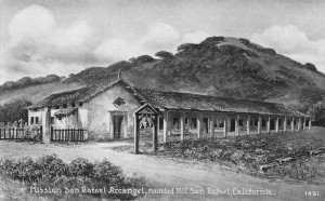
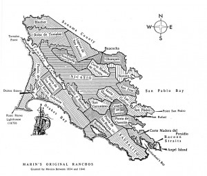
When in 1834 the Mexican government secularized the missions and seized their property, Mission San Rafael was the first to go. The mission’s extensive lands in Marin were divided into 21 land grants, and the summit of Sugar Loaf (Red Hill) was used as a convenient property corner for three of these grants.
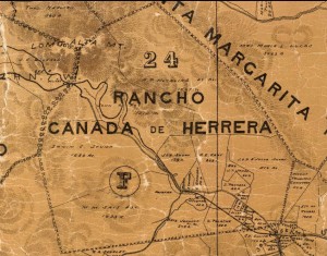
The first grant, in 1839, was Cañada de Herrera, a grant of over ten square miles extending west from Red Hill, and including western San Anselmo, Sleepy Hollow, and Fairfax. Acting governor Manuel Jimeno awarded the land to Domingo Sais, a 33-year-old Mexican soldier, as a reward for his service.
To the south of Red Hill was the huge 14-square-mile Rancho Punta de Quintin, Corte de Madera, la Laguna y Cañada de San Anselmo, which included the eastern part of San Anselmo, Ross, Kentfield, and San Quentin Point. In 1840 it was granted to 49-year-old English sea captain John Rogers Cooper, who had married the sister of General Vallejo and also owned extensive lands in Nicasio and Big Sur. In 1852, Cooper sold his grant to Benjamin Buckelew who in turn sold it to James Ross and Henry Cowell in 1857 for $50,000 in gold coin. James Ross became the sole owner that same year. On the map below, the red arrow marks Red Hill or Sugar Loaf.
The third grant was awarded to Timothy Murphy, an Irishman who had been appointed administrator of Mission San Rafael in 1837. As a reward for his services, Governor Micheltorena in 1844 gave him the immense nearly 34-square-mile Rancho San Pedro, Santa Margarita, y Las Gallinas, including everything from Terra Linda to Point San Pedro, all of the current city of San Rafael, and terminating on the east side of Red Hill. In the 1910 photograph below, the fence line running from the top of Red Hill demarcates the original Murphy grant (on the right) from the Rancho Punta de Quintin (on the left).
More than fifty-eight square miles of eastern Marin County was thus divided among just three men, and the common corner of their lands was Red Hill. Even today, property lines and city limits radiate from the summit.


